


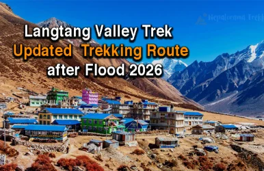
Langtang Valley Trek After Flood follows an alternative route via Thulo Syabru after the August 2026 flash flood. The Bhotekoshi

Team Nepalorama

The Langtang Valley Trek map clearly shows one of Nepal’s most beautiful and accessible trekking routes, located north of Kathmandu near the Tibet border. This trek is perfect for travelers who want stunning mountain views, rich Tamang culture, glaciers, and alpine valleys without long flights or extreme difficulty.

In this blog, we explain the Langtang Valley Trek route step by step, using the route shown on the map, in simple and easy terms.
The Langtang Valley Trek is starts from Kathmanduand follows a scenic mountain road to Syabrubesi. From there, the trail gradually climbs through forests, rivers, and traditional villages to reach Kyanjin Gumba (3,865 m) which is the heart of Langtang Valley.
The trek then returns via the same route, making it safe, well-marked, and suitable for both beginners and experienced trekkers.
Day 1: Arrival in Kathmandu
Your journey begins in Kathmandu. This day is mainly for arrival, rest, and trek preparation. If you want to visit thamel you can enjoy the market street.
Day 2: Drive from Kathmandu to Syabrubesi (1,460 m)
After morning breakfast we start to scenic drive through hills, rivers, and rural villages takes you to Syabrubesi, the starting point of the Langtang Valley Trek. You’ll pass Dhunche, Trishuli, and Kakani on the way.
Day 3: Syabrubesi to Lama Hotel (2,470 m)
The trek officially starts. The trail follows the Langtang River, passing Bamboo and dense forests. You may spot monkeys and birds along the way. Overnight stay at Lama Hotel.
Day 4: Lama Hotel to Langtang Village (3,430 m)
The trail climbs gradually through pine and rhododendron forests. You pass Ghodatabela before reaching Langtang Village, which was rebuilt after the 2015 earthquake.
Day 5: Langtang Village to Kyanjin Gumba (3,865 m)
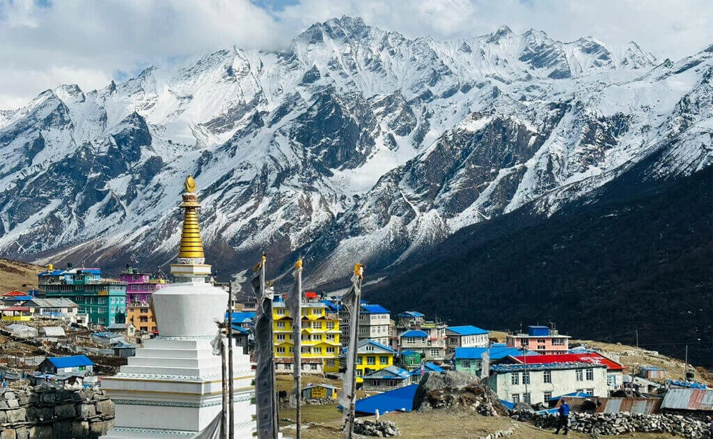
This is a short and scenic walk. You will see wide valleys, prayer flags, and snow-covered peaks like Langtang Lirung (7,246 m). Kyanjin Gumba is surrounded by mountains and glaciers.
Day 6: Acclimatization Day – Hike to Kyanjin Ri (4,400 m)
From Kyanjin Gumba, you hike to Kyanjin Ri, a popular viewpoint marked on the map. From here, you can see Langtang II, Yala Peak, and Tsergo Ri. This day helps your body adjust to altitude.
Day 7: Kyanjin Gumba to Lama Hotel
You retrace the same trail back down. Descending is easier and faster, with familiar scenery.
Day 8: Lama Hotel to Syabrubesi (via Sherpagaon)
The route continues downhill through forests and villages, ending back at Syabrubesi.
Day 9: Drive from Syabrubesi to Kathmandu
After breakfast, you drive back to Kathmandu, enjoying the last views of the Langtang region. After reach Kathmandu we can enjoy with our farewell dinner in 3 star hotel.
Day 10: Departure from Nepal
The trek officially ends. You depart with unforgettable Himalayan memories.
Mountains and Viewpoints Shown on the Langtang Trek Map
According to the map, major highlights include:
These peaks make the Langtang Valley Trek one of the most scenic short treks in Nepal.
The Langtang Valley Trek map is one of the most beginner-friendly and practical trekking maps in Nepal. It clearly shows a safe, scenic, and well-organized route, making it ideal for a wide range of trekkers.
Suitable for beginners and families
The route follows a straightforward trail with comfortable daily walking hours. There are regular tea houses and villages along the way, making it a good choice for first-time trekkers and families with older children.
Easy-to-follow main route
The trek mainly follows one main trail with minimal confusing junctions. The Langtang Valley Trek map clearly marks villages, rest points, and viewpoints, helping trekkers stay on track.
No flights required
Unlike Everest or remote treks, Langtang Valley can be reached by road from Kathmandu. This reduces travel risk, cost, and delays caused by flight cancellations.
Gradual altitude gain
The trail gains altitude slowly, allowing the body to adjust naturally. Acclimatization points like Kyanjin Gumba and Kyanjin Ri are clearly marked on the map, reducing the risk of altitude sickness.
Clear viewpoints and rest villages
The map highlights important viewpoints such as Kyanjin Ri and well-spaced villages like Lama Hotel and Langtang Village, making daily planning easier and safer.
Close to Kathmandu
Located just north of Kathmandu, Langtang Valley is one of the most accessible trekking regions in Nepal. Short travel distance means more time on the trail and less time on the road.

Krishna is the Managing Director of our unique Nepal trekking company – Nepalorama Trekking. He has over 20 years of trekking experience in Nepal and has been guiding treks since 2010. He’s well known for his warm sense of humour and cheeky smile. Nepalis are understandably proud of their beautiful country and Krishna is no exception!
Read more Articles by this Author
Langtang Valley Trek After Flood follows an alternative route via Thulo Syabru after the August 2026 flash flood. The Bhotekoshi
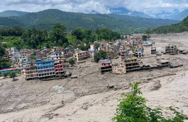
A massive and sudden Bhote Koshi flood struck Rasuwa district on August 26, 2026, after an unusually large surge of

Langtang Valley Trek Packing List Planning to trek in the beautiful Langtang region? One of the most common questions trekkers


Loading please wait...