


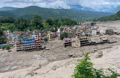
A massive and sudden Bhote Koshi flood struck Rasuwa district on August 26, 2026, after an unusually large surge of

Team Nepalorama

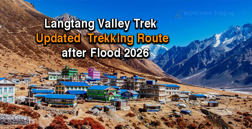
Langtang Valley Trek After Flood follows an alternative route via Thulo Syabru after the August 2026 flash flood. The Bhotekoshi flood caused significant damage to roads, bridges, and settlements around Syabrubesi. However, trekking access to the beautiful upper Langtang Valley can be arranged through the updated route via Thulo Syabru, depending on current local road and trail conditions.
For trekkers planning to visit Langtang in the coming season, the experience remains focused on the spectacular Himalayan landscapes, Tamang culture, forests, Buddhist heritage and high-altitude viewpoints around Kyanjin Gompa, Kyanjin Ri and Tserko Ri.
The updated itinerary below is designed to reduce dependence on the damaged traditional access route and provide a practical way to reach the Langtang Valley.
Important travel update: Conditions in the flood-affected Rasuwa region can change quickly. Roads, bridges, trails and local services may be repaired or modified during the recovery period. Travelers should confirm the latest trail, road and accommodation conditions with their trekking agency and local authorities before departure.
The August 26, 2026 Bhotekoshi flood severely affected parts of Rasuwa, including Syabrubesi and road infrastructure connecting the area. Reports from September indicate that the traditional road access has remained disrupted while authorities continue reconstruction and alternative access work.
However, the Langtang Valley trekking trail itself can be approached through alternative starting points, including the Thulo Syabru side. Recent trekking reports describe Langtang Valley access through an updated route while the traditional Syabrubesi approach is being restored.
This means trekkers do not necessarily have to abandon their Langtang plans. Instead, the itinerary and transportation arrangements need to be adapted to the current conditions.
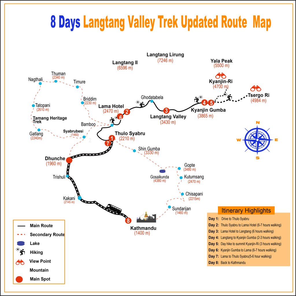
langtang valley trek Itinerary via thulo syabru after flash flood 2026
Day 1: Kathmandu → Thulo Syabru by private 4WD Jeep
Day 2: Thulo Syabru → Lama Hotel
Day 3: Lama Hotel → Langtang Village
Day 4: Langtang Village → Kyanjin Gompa
Day 5: Kyanjin Gompa → Kyanjin Ri / Tserko Ri → Kyanjin Gompa
Day 6: Kyanjin Gompa → Lama Hotel
Day 7: Lama Hotel → Thulo Syabru
Day 8: Thulo Syabru → Kathmandu by private vehicle
Drive: Kathmandu → Thulo Syabru
Transport: Private 4WD Jeep
Overnight: Thulo Syabru
Instead of following the traditional road approach directly to Syabrubesi, this updated itinerary uses Thulo Syabru as the starting point.
The proposed alternative route is:
Dhunche (≈1,950 m) → Bharku (≈1,860 m) → Thulo Syabru (≈2,230 m)
A private jeep provides greater flexibility when road conditions and local access points change during the recovery period. The drive passes through the hills of Nuwakot and Rasuwa, offering beautiful views and changing landscapes along the way. From Dhunche to Thulo Syabru, the journey takes approximately 3–4 hours, depending on road conditions. The road is currently off-road and bumpy in some sections, so the journey may take longer than usual. Along the way, you can enjoy scenic views as the landscape changes from the hills around the Kathmandu Valley to traditional mountain villages and the surrounding Himalayan scenery.
Thulo Syabru is an important settlement and gateway for trekking in the Langtang region.
After reaching Thulo Syabru, you can rest, prepare your trekking equipment and meet your guide before beginning the walk the following morning.
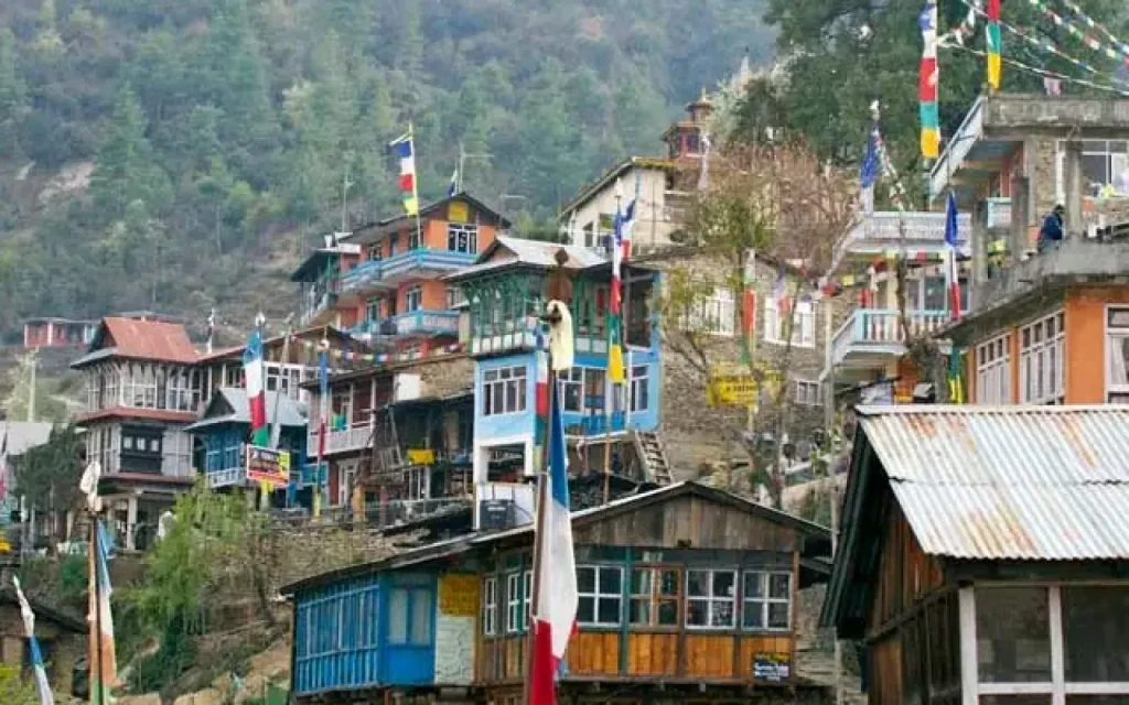
Why start from Thulo Syabru?
Trek duration: Approximately 5–7 hours
Overnight: Lama Hotel
Your Langtang Valley trekking adventure begins from Thulo Syabru.
The trail gradually enters the forested landscape of Langtang National Park, with sections of rhododendron, oak, pine and Himalayan vegetation.
As you walk deeper into the valley, the surroundings become quieter and more mountainous. Depending on weather and trail conditions, you may encounter monkeys, Himalayan birds and other wildlife.
The trail eventually connects with the route toward Lama Hotel, one of the traditional overnight stops on the Langtang Valley Trek.
Langtang National Park covers a large area of Rasuwa, Nuwakot and Sindhupalchok and protects ecosystems ranging from subtropical forests to alpine landscapes.
Overnight: Lama Hotel.
Trek duration: Approximately 5–7 hours
Overnight: Langtang Village
After breakfast, continue trekking through the forest along the Langtang Khola.
The trail gradually gains elevation as you pass through settlements and forest sections toward the upper valley.
As you climb higher, the landscape begins to open and Himalayan peaks become more prominent.
After passing through areas around Ghoda Tabela, the trail continues toward Langtang Village, an important cultural and historical settlement in the valley.
Langtang Village was rebuilt after the 2015 earthquake and remains one of the significant settlements along the trekking route.
The higher you go, the more dramatic the mountain scenery becomes.
Overnight: Langtang Village.
Trek duration: Approximately 3–5 hours
Destination: Kyanjin Gompa
Elevation: Around 3,870–3,890 m
This is one of the most exciting days of the Langtang Valley Trek.
The trail passes through Mundu, Sindhum and other small settlements before reaching Kyanjin Gompa.
The landscape changes rapidly as you enter the upper Langtang Valley. You will see stone-built settlements, Buddhist mani walls, prayer flags, chortens and spectacular mountain views.
Kyanjin Gompa – The Heart of Langtang Valley
Kyanjin Gompa is the main destination of the Langtang Valley Trek and serves as the base for several high-altitude day hikes.
From Kyanjin Gompa, trekkers can explore viewpoints such as:
Nepal Tourism Board also identifies Kyanjin as an area where visitors can extend their Langtang experience and explore the upper valley toward Langshisa and beyond.
Spend the night at a local teahouse in Kyanjin Gompa.
Starting point: Kyanjin Gompa
Destination: Kyanjin Ri or Tserko Ri
Overnight: Kyanjin Gompa
This is the highlight of the trek.
After an early breakfast, choose your high-altitude viewpoint according to your fitness, weather, guide’s advice and current trail conditions.
Option 1: Kyanjin Ri
Kyanjin Ri provides spectacular views of Langtang Lirung and the surrounding Himalayan range.
Different route descriptions give slightly different elevations for the Kyanjin Ri viewpoints, so the exact summit point should be confirmed locally with your guide.
The climb is steep in sections, but the panoramic mountain scenery makes the effort worthwhile.
Option 2: Tserko Ri
For trekkers seeking a longer and more challenging summit hike, Tserko Ri is the higher viewpoint.
Tserko Ri is commonly listed at approximately 4,984–4,985 m, although elevation figures can vary slightly by mapping source. Recent trekking references describe it as a demanding day hike from Kyanjin Gompa with extensive Langtang mountain views.
From the high viewpoints, you may see spectacular peaks including:
After completing the hike, return to Kyanjin Gompa for an overnight stay.
Why spend an extra night at Kyanjin Gompa?
The additional night allows you to:
Trek duration: Approximately 5–7 hours
Overnight: Lama Hotel
After breakfast, begin your return journey.
The trail follows the same general valley route back toward Lama Hotel.
Because most of the day is downhill, trekking poles can be useful, particularly after the demanding summit hike.
The return journey provides a different perspective of the Langtang Valley, with changing views of forests, rivers, cliffs and Himalayan peaks.
Overnight: Lama Hotel.
Trek duration: Approximately 5–7 hours
Overnight: Thulo Syabru
Continue descending through the forest toward Thulo Syabru.
The lower altitude makes the walking more comfortable after several days at high elevation.
Enjoy the final sections of the trek through the green hills and traditional settlements of the Langtang region.
Reach Thulo Syabru, where you spend your final trekking night.
Transport: Private vehicle
Destination: Kathmandu
After breakfast, drive from Thulo Syabru toward Kathmandu.
Depending on the current road condition, the exact driving route and travel time may change. Your trekking agency should confirm the latest road access before departure.
Once you reach Kathmandu, your updated Langtang Valley Trek comes to an end.
Updated Langtang Valley Trek Route
Kathmandu → Thulo Syabru → Lama Hotel → Langtang Village → Kyanjin Gompa → Kyanjin Ri / Tserko Ri → Kyanjin Gompa → Lama Hotel → Thulo Syabru → Kathmandu
This route is designed around the current post-flood access situation and can be adjusted according to local road and trail conditions.
Is Langtang Valley Trek Open After the 2026 Flash Flood?
The answer needs some context.
The August 26, 2026 Bhotekoshi flood caused major damage around Syabrubesi and disrupted traditional road access to Langtang. Roads, bridges and parts of settlements were washed away, and reconstruction has been ongoing.
At the same time, recent trekking reports indicate that Langtang Valley can be reached using alternative approaches, including the Thulo Syabru/Dhunche side, while the damaged road infrastructure is being repaired.
Therefore, trekkers should understand the difference between:
Traditional road access: affected and under recovery.
Updated trekking access: possible through alternative arrangements, subject to current local conditions.
Before every departure, check the latest road, trail, bridge and accommodation situation.
Is It Safe to Trek Langtang After the Flood?
Safety conditions should be assessed on the actual departure date rather than relying on an old itinerary.
The flood changed parts of the landscape and damaged infrastructure in Rasuwa. Some roads and bridges remain under reconstruction.
For this reason, a responsible Langtang trekking company should:
Do not assume that a route is safe simply because it was open previously. Conditions can change after heavy rainfall or landslides.
Trekking in Langtang is not only about reaching the mountains.
It also provides an opportunity to support local communities whose tourism infrastructure has been affected by the disaster.
The Langtang region offers a combination of:
Himalayan Mountain Views
The upper Langtang Valley provides close views of spectacular Himalayan peaks, including Langtang Lirung and surrounding mountains.
Tamang Culture
The journey passes through communities with strong Tamang cultural traditions, Buddhist practices, prayer flags, monasteries and mani walls.
Langtang National Park
The trekking route passes through Langtang National Park, home to diverse Himalayan ecosystems and wildlife. The park officially lists species including red panda, Himalayan tahr, musk deer, ghoral, serow and Himalayan black bear.
Kyanjin Gompa
Kyanjin Gompa is the upper-valley base for exploring some of the region’s most impressive viewpoints.
Kyanjin Ri and Tserko Ri
These high-altitude hikes provide an opportunity to experience panoramic views without undertaking a technical mountaineering expedition.
Traditionally, the best trekking seasons for Langtang are spring and autumn.
Spring: March to May
Spring brings:
Autumn: October to November
Autumn generally offers:
Nepal Tourism Board identifies March–May and October–November as the main favorable periods for the Langtang region, while monsoon and winter bring different weather and trail conditions.
For the post-flood period, however, current trail and road conditions are more important than the season alone.
The Langtang Valley Trek is generally considered a moderate Himalayan trek, but the difficulty increases significantly on the optional high-altitude summit day.
The main challenges include:
Trekkers should walk at a comfortable pace and communicate immediately with their guide if they develop symptoms of altitude sickness.
If you are planning the trek during the recovery period, keep these points in mind:
1. The starting point may be different.
The traditional Syabrubesi approach may not be practical because of damaged infrastructure.
2. The itinerary may change.
Your guide may adjust walking stages according to trail conditions.
3. Private transportation is useful.
A private 4WD provides greater flexibility when road access changes.
4. Check accommodation before departure.
Some properties in affected settlements may have been damaged or may be temporarily unavailable.
5. Carry flexibility in your schedule.
Allow extra time for unexpected road or trail changes.
6. Follow local instructions.
Local authorities and experienced guides have the most current information about changing conditions.
Langtang Valley Trek: An Opportunity to Support Local Recovery
Tourism plays an important role in the economy of mountain communities.
Choosing local teahouses, hiring local guides and porters, purchasing local products and using local transportation can help tourism income reach communities directly.
After a major natural disaster, responsible tourism should not mean ignoring the risks. It means traveling when access is permitted, respecting local conditions and supporting communities while prioritizing safety.
The Langtang Valley remains one of Nepal’s remarkable Himalayan trekking destinations, combining mountain scenery, Tamang culture, Buddhist heritage, forests and high-altitude viewpoints.
Following the 2026 flash flood, the approach to the region has changed, so the itinerary must be planned according to the latest local conditions.
If you are planning a Langtang Valley Trek in 2026/27, Nepalorama Trekking can arrange the updated itinerary with private transportation, a licensed trekking guide, accommodation and route planning.
Contact Nepalorama Trekking
WhatsApp/Call: +977-9849252021
Email: [email protected]
Kathmandu, Nepal
Note: Because the Langtang region is recovering from a major flood, the final starting point, road access and daily itinerary may be adjusted according to current local conditions.
Is Langtang Valley Trek open after the 2026 flash flood?
Langtang Valley trekking access can be arranged through updated approaches, including the Thulo Syabru side, while traditional road access around Syabrubesi has been affected by flood damage. Current trail and road conditions should be confirmed before departure.
Can I start the Langtang Trek from Thulo Syabru?
Yes, the updated itinerary can use Thulo Syabru as the trekking starting point, subject to current local access and trail conditions.
Can I still visit Kyanjin Gompa?
Kyanjin Gompa remains the main destination of the Langtang Valley Trek, and the updated route is designed to reach Kyanjin through an alternative approach.
Can I climb Tserko Ri?
Tserko Ri can be included as an optional high-altitude day hike from Kyanjin Gompa. The commonly cited elevation is approximately 4,984–4,985 m. Weather, trail conditions, fitness and guide assessment should determine whether the hike is attempted.
Is Langtang Trek safe after the flood?
Safety depends on current trail, road, weather and infrastructure conditions. The flood caused major damage in the Rasuwa region, so travelers should obtain a current local assessment before departure rather than relying on pre-flood information.
What is the highest point of the Langtang Valley Trek?
If you include the optional Tserko Ri hike, the highest point is approximately 4,984–4,985 m. Kyanjin Gompa itself is around 3,870–3,890 m.
How many days is the updated Langtang Valley Trek? The itinerary presented here takes 8 days, beginning with a private jeep drive from Kathmandu to Thulo Syabru and ending with the drive from Thulo Syabru back to Kathmandu.

Krishna is the Managing Director of our unique Nepal trekking company – Nepalorama Trekking. He has over 20 years of trekking experience in Nepal and has been guiding treks since 2010. He’s well known for his warm sense of humour and cheeky smile. Nepalis are understandably proud of their beautiful country and Krishna is no exception!
Read more Articles by this Author
A massive and sudden Bhote Koshi flood struck Rasuwa district on August 26, 2026, after an unusually large surge of

Langtang Valley Trek Packing List Planning to trek in the beautiful Langtang region? One of the most common questions trekkers

Best Food, Tea Houses, Lodges & Stay Experience in Langtang Valley Trek The Langtang Valley Trek food and accommodation experience


Loading please wait...